![]()
![]()
September 15, 2018
After completing some outside obligations we did a small re-arrangement in our schedule and set out to find the Vya Obsidian Field and and the UFO Landing Strip. Today we had a good size gang consisting of Tom, Deb, Chuck, Dave, Brandy Sharp, Jim Hunt and Rich Ostaggi.
We headed north on Rt 34 past the Lund Petrified Forest up to the Duck Flat turn off (41° 13' 10.0" N 119° 28' 50.4" W) better known as Cottonwood Creek Rd. Our first goal was the UFO Site about 9½ miles from the Rt 34 turn off. At 41° 06' 13.7" N 119° 33' 22.3" W we turned left onto a dirt road and supposedly drove to the UFO Site. We drove for awhile looking in all directions for any sign of a landing strip. According to our maps we should be driving on one of the 'runways' but there was absolutely no sign of anything other than open flat un-marked land. We eventually came to the end of the road and a big downhill slope. We did not know it at the time but we were actually driving on the 'runway'. We turned around and drove back until we found a 'road' on the left heading west, so we turned there and found out it brought us back out onto Cottonwood Creek Road. Apparently the large "X" on the map can only be seen from the sky. If it every was a landing strip there is nothing around for it reason to exist.
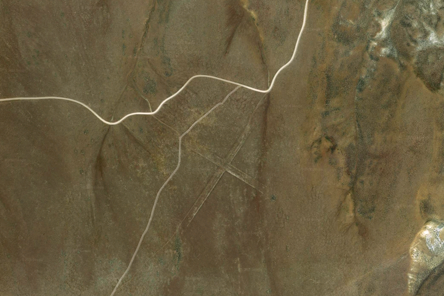
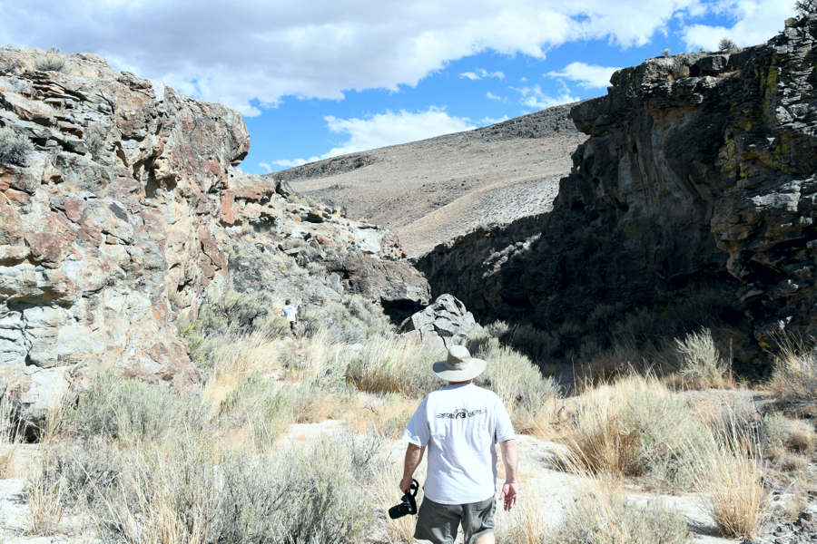
Turning left we headed for the Vya Obsidian Field located about 3 miles West at 41° 06' 11.88" N 119° 36' 21.60" W . When we arrived at our marker we looked in all directions and saw nothing but open flat land. All indications and references on the internet described the area as a wealth of Obsidian, petrified wood and other items of interest. All we saw was open flat land with a few ridges to the North.
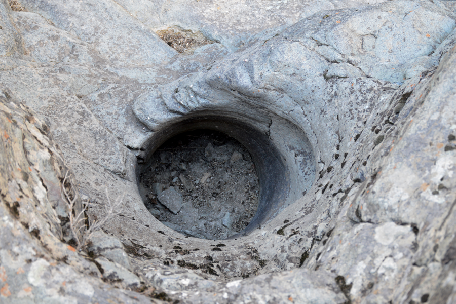
Tom and Rich jumped into the side by side and took a quick reconnaissance run to the ridge to see if there was anything there of worth seeing. As we drove closer we could see what looked like caves in the ridge of rocks. Driving practically up to them we found them to be just shallow cave indents used by animals as shelter in bad weather, and not good shelter at that.
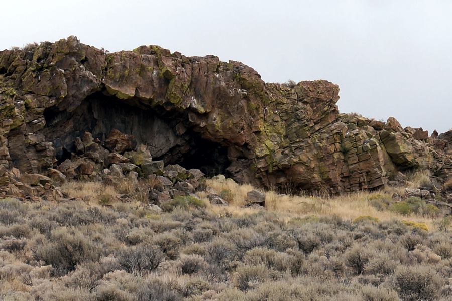
The 'Caves" proved to be nothing more than animal shelters.
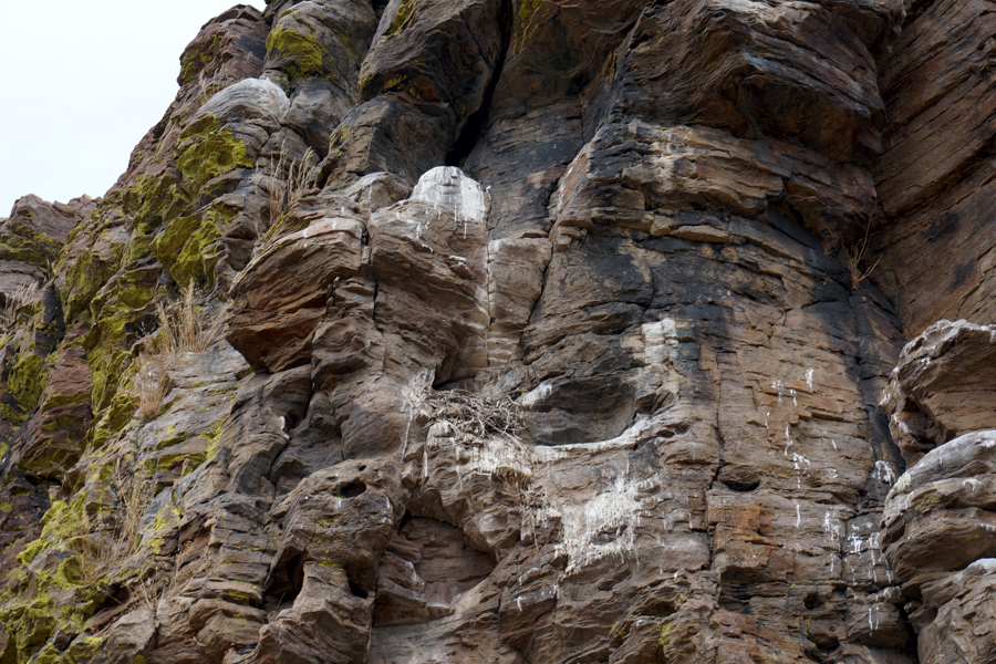
There were nests and signs of large birds in the area.
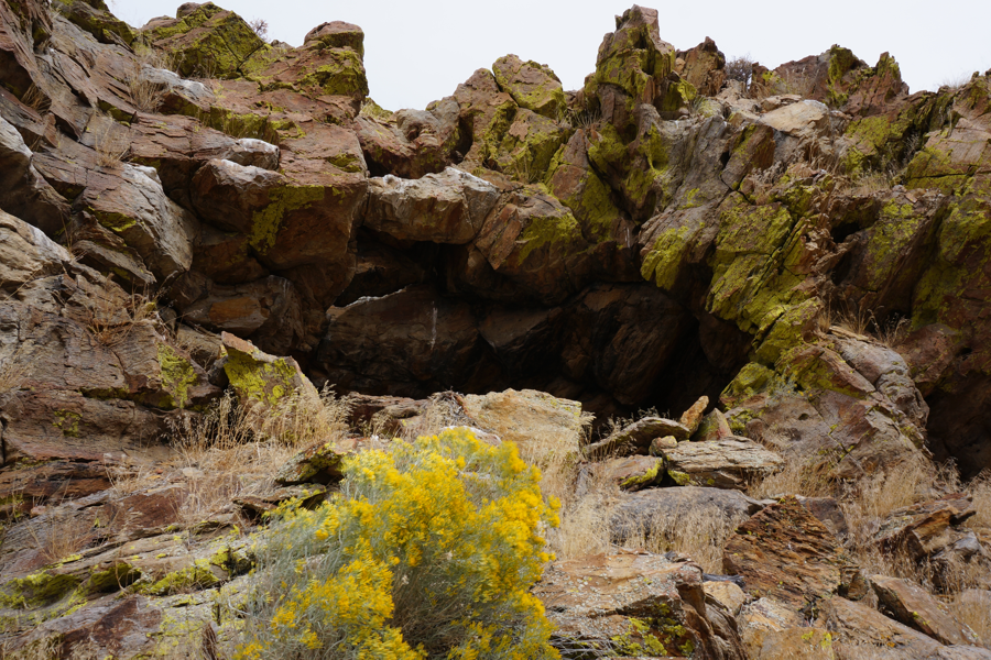
Although the 'caves' looked large they all were very shallow upon entry
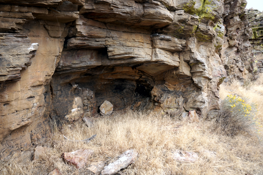
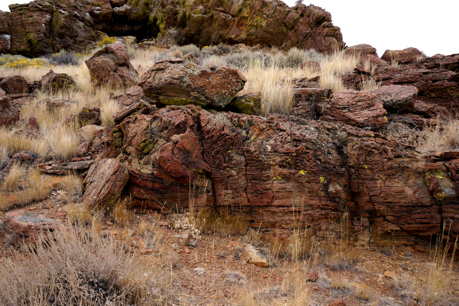
About the only thing of interest was the huge amount of twisted rock from an ancient Lava Flow.
With skies growing dark with rain clouds we got a call from those waiting back at the vehicles that we should return as it was starting to rain where they were at. Once all together we discussed our options for the day. The road we were on Cottonwood Creek, if continued on, would turn into Lost Creek Road and take us to Devil's Gate and a quick return back to Gerlach. Or, we could turn round and head back to High Rock Reservoir, the Pot Holes and Soldier Meadows. We all agreed on the latter.
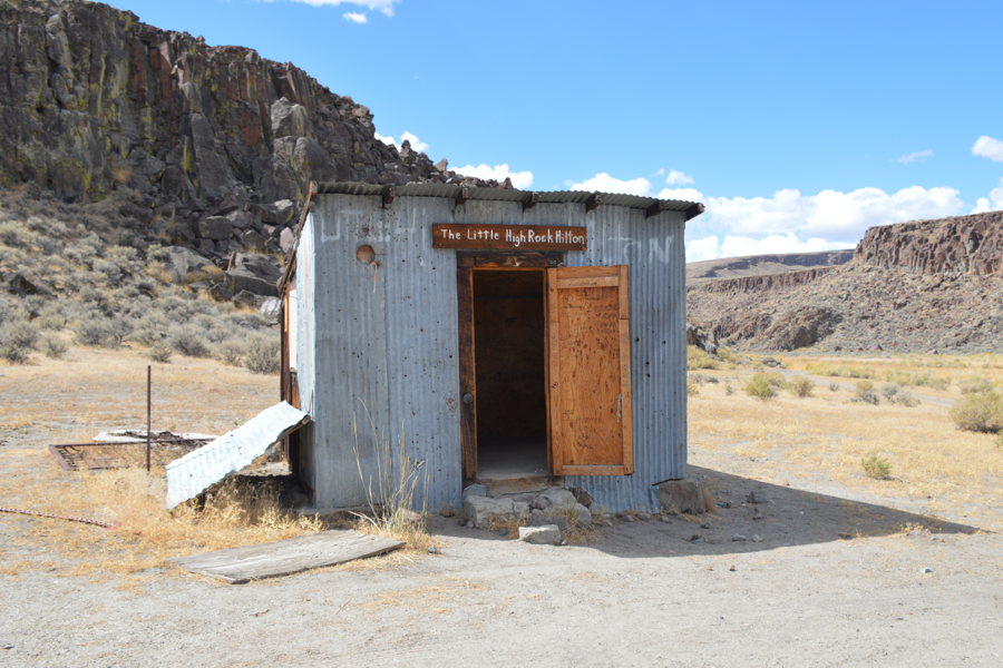
Back on Rt34 heading South we turned East at 41° 09' 39.4" N 119° 23' 13.4" W which is the road best know to take you to High Rock Canyon. There is a sign marking the route. This road also leads you to High Rock Lake, Fly Canyon and the Pot Holes. At the entrance to Little High Rock Canyon where sits the Little High Rock Hilton (41° 16' 06.50" N 119° 18' 30.90" W). Little High Rock Hilton is a overnight shelter for travelers and those caught in bad weather. It has nothing to offer except four walls and a roof but as they say, "Any shelter in a storm".
The road straight past the Hilton heads up into Little High Rock Canyon.
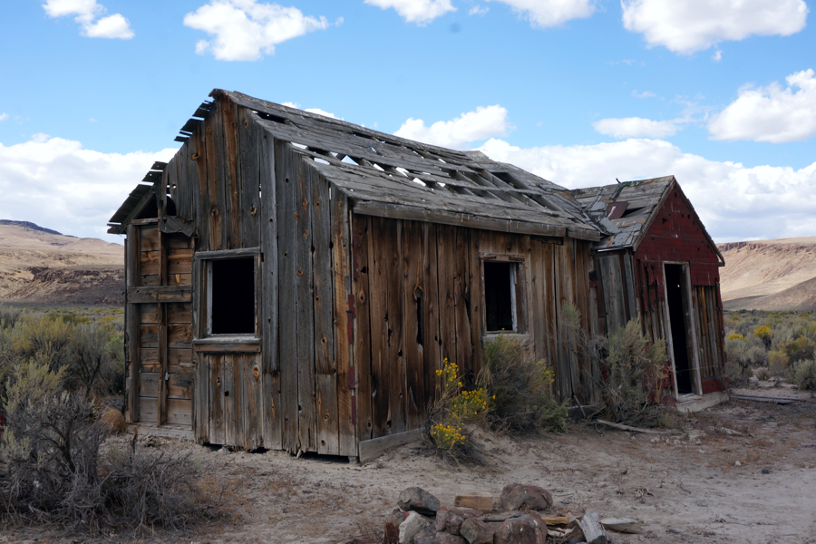
After a rest with rain clouds completely gone and beautiful blue skies, we head for the shore of High Rock Reservoir (41° 17' 26.0" N 119° 17' 20.4" W). Off in the distance, if you look, you can see a few old buildings. As we got closer you could see several dilapidated wooden structures standing at (41° 17' 52.8" N 119° 17' 43.8" W) These are the remains of a little identified town, probably having something to do with the early settlers migration up High Rock Canyon - although we doubt these are the original buildings.
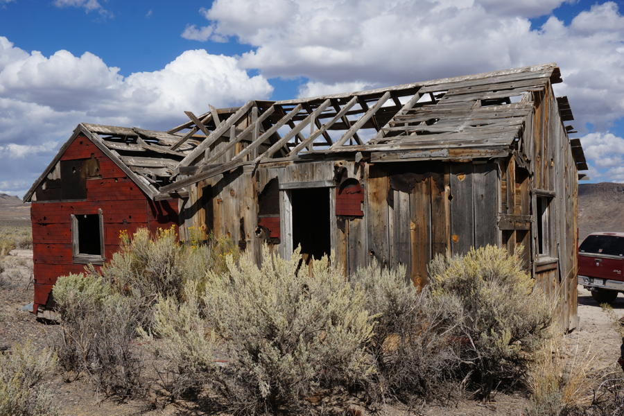
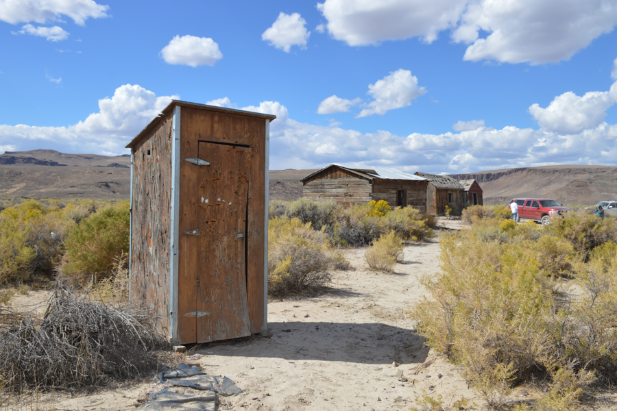
Someone in the past referenced this area as High Rock Saloon and the name has stuck. In actuality Ogle Swingal once owned a ranch at this location. Swingal cut hay around the northwestern shores of shallow High Rock Lake. The largest building is possibly Ogle's ranch house. There are three buildings and an outhouse (very popular) still remaining, although they are getting really tired.
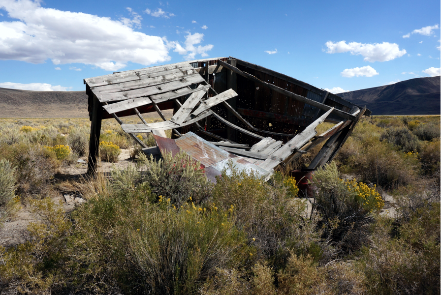
One building is collapsed and time is eating it up.

Another building is a railroad tie structure that still has a long life going for it. These types of buildings were very popular back in the railroad days and you can find them all over the Black Rock area even though there is no railroad within 50-60 miles anywhere.
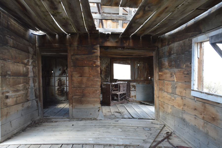
The third building (probably the ranch house of early settler Ogle Swingal) is still standing but very tired. It has multiple rooms and a storage cellar under what was the kitchen. This is the building referred to today as the Black Rock Saloon.
The backside shows real deterioration while the inside is clean but just as bad.
There is always a friendly building around in the most isolated places.
This old settlement sits right on the shores of High Rock Lake, a large flat 'used-to-be lake' which flowed out of Box Canyon on the far shore. It drained East to created Fly Canyon, our next goal. Moving further East we Trekked in search of the Pot Holes in Fly Canyon. We drove down the dirt road skirting the empty High Rock Lake. There was some water on the south end of the lake but nothing like it's heyday when it was a full active lake flowing its water down Fly Canyon and on down into Mud Meadows.
Right at the beginning of Fly Canyon, about 2 miles East, we found the area called the Pot Holes, 41° 18' 58.2" N 119° 16' 23.0" W. We stopped on the dirt road and hiked about
From the road there is no sign of anything of interest but a walk of about 250 feet down a rock strun section revealed several empty 'pot holes'. These are naturally formed bowl shaped holes in the rocks that make you wonder just how they were formed. The best sight was seeing a deep water tank. This large tank is usually dry and showing a few Pot Holes in its base but on our arrival we discovered it was filled with a good quantity of green water.
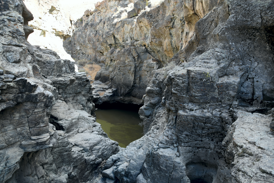
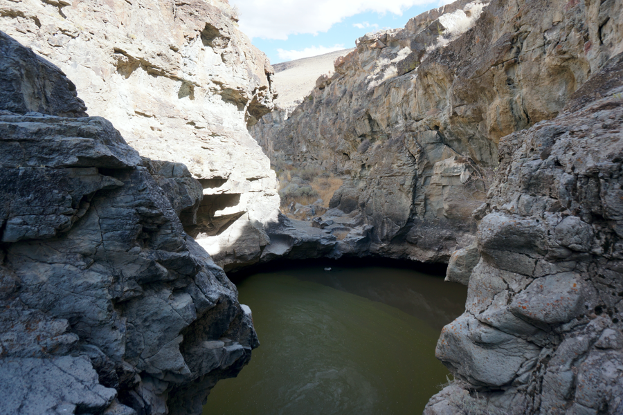
It is said the Indians used this for their water supply. There is no way to reach water without buckets and rope.
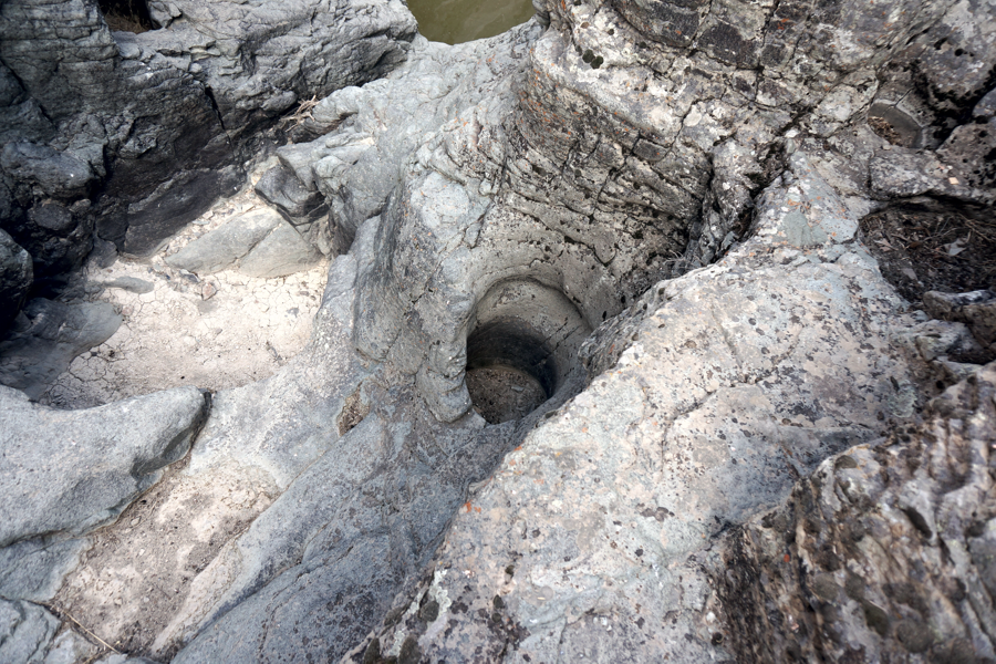
Pot Holes can be found by walking around. A lot of them are perfect cylindrical holes as if drilled
.
Some say the potholes were carved by whirlpool action of sand and gravel in the stream over centuries.
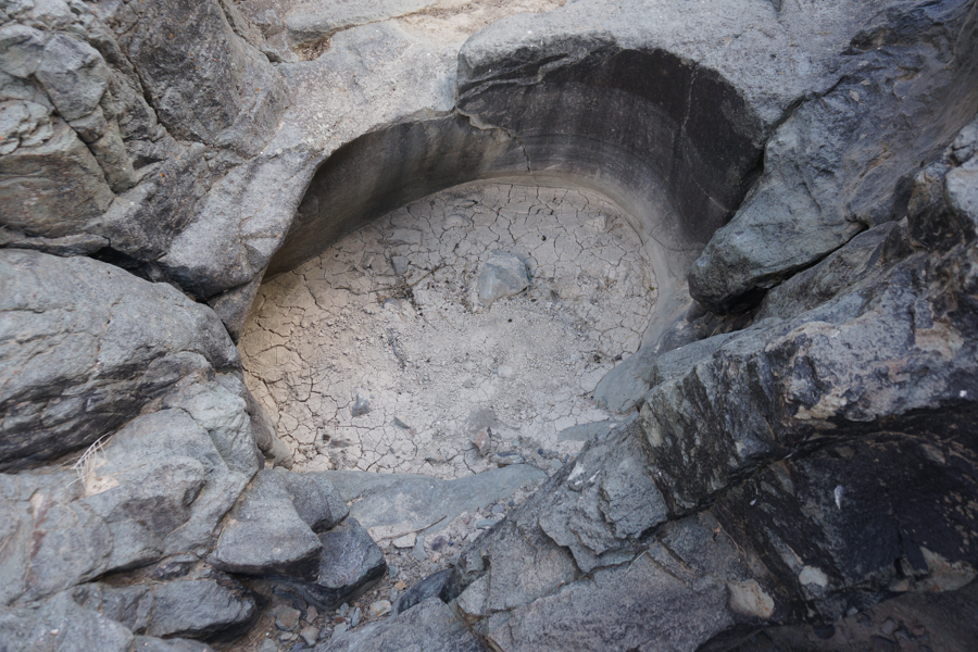
While some have rounded bottoms, many are flat bottom, probably filled with ages of dirt and silt.
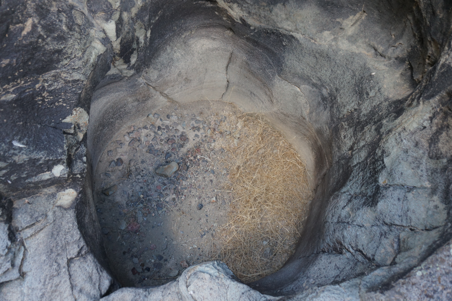
Many of the more shallow pot holes are used by animals. You can see the years of fill
creating the flat bottoms.
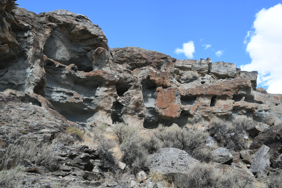
As we left we stopped to check out the wall of 'caves'. (41° 18' 57.2" N 119° 16' 23.2" W) These are the first thing seen when heading down to the Pot Holes. Most are animal dens but some are large enough for early Indian use. We could explore them better, there's always next year. Time was pressing and we wanted to find the Wagon Slide and end up at Soldier Meadows Ranch.
We headed East along the road and skirted Fly Canyon following it as it carved it's way down hill. At 41° 19' 08.9" N 119° 15' 48.8" W we stopped at a trail Marker identifying the Applegate Trail and the Wagon Slide.
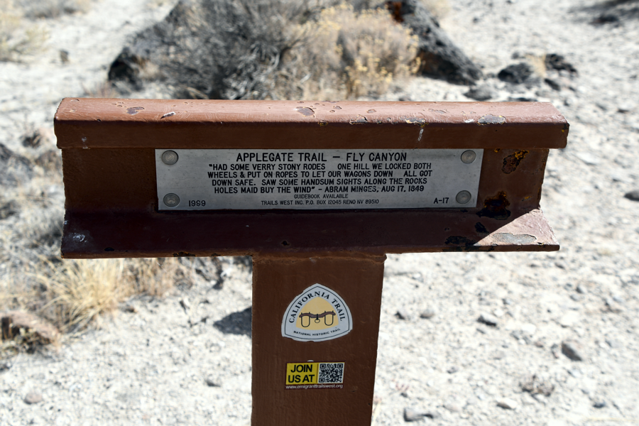
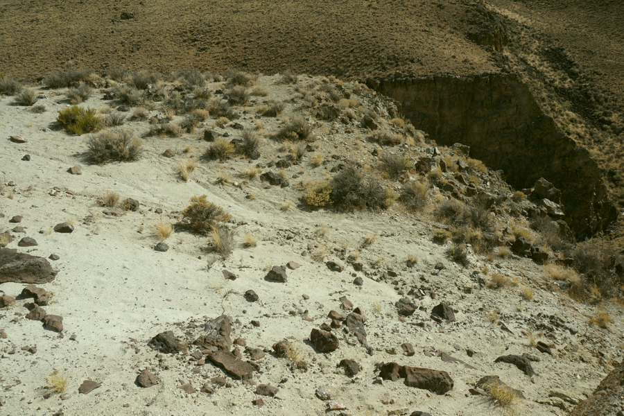
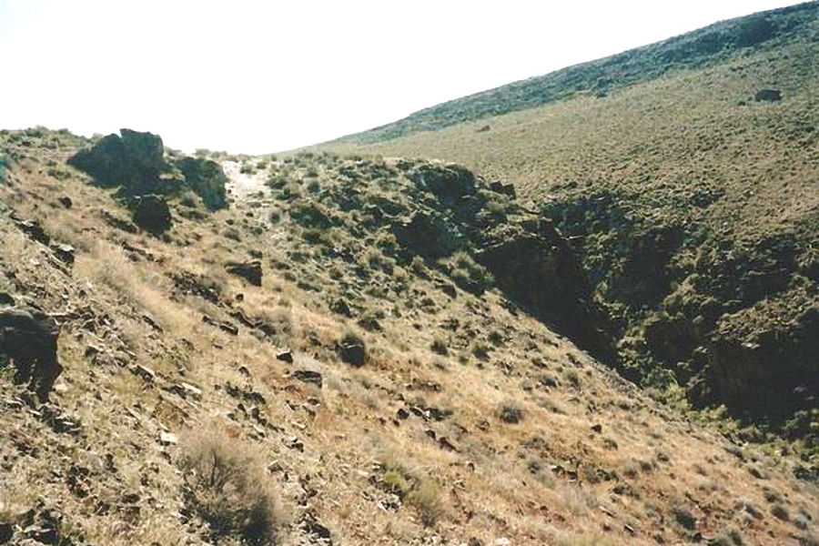
This is the site of the Applegate Wagon Slide. Immigrants traveling up from Mud Meadows found an impasse. The only course available was to get down a steep 45º hill into a flat open meadow area below. They locked their wagon wheels with rope and slid then down the hill minus the oxen and assisted with ropes. Many wagons never made it down and today one wonders 'what were they thinking'. The hill is not high but it is rather steep and long and if you look around a bit you can find the tracks of the wagons ground into the rocky slope.
The Wagon Slide starts out easy and quickly dives 45º to the meadow floor below.
Looking at the floor below it is hard to see just why they had to go down, and once down just where did they go from there - it's all Fly Canyon rocks.
We continued our Trek East, down the long dirt road toward Mud Meadows and Soldier Meadows Ranch. Soldier Meadows is a working cattle ranch with accommodations for people wanting to get away from the hustle and bustle of modern life (mostly Californians). While the ranch is designed for cattle life there are two super nice apartments in a duplex type building supplying nice clean living quarters - or you can bunk with the Cowhands.
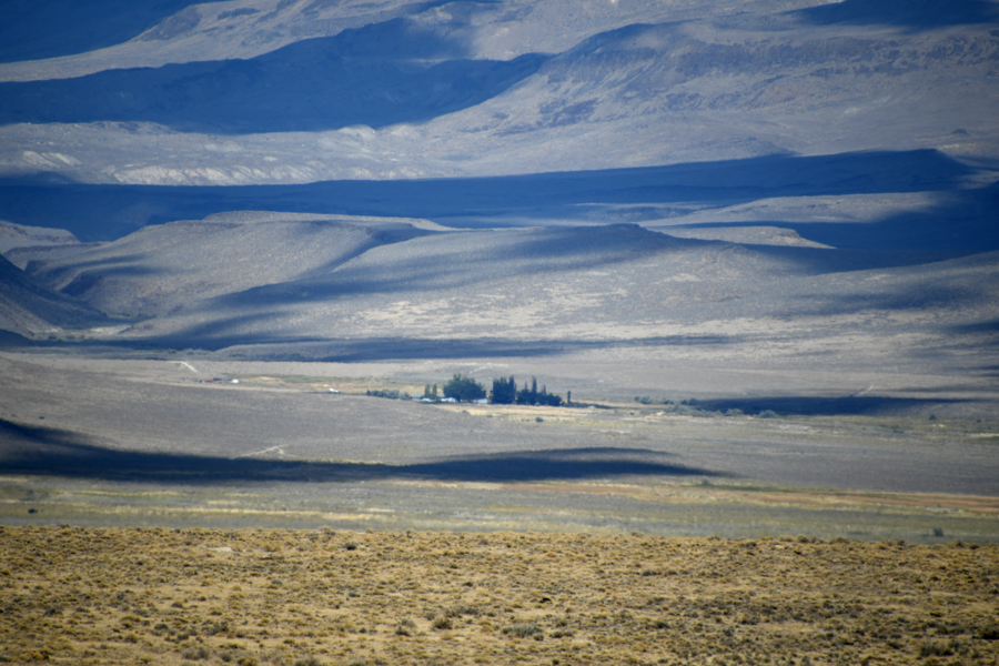
Off in the distance sits Soldier Meadows. 41° 23' 39.6" N 119° 09' 40.4" W
The late afternoon clouds cast nice shadows as they race overhead.
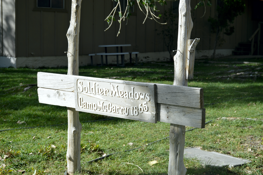
Soldier Meadows is the former site of Camp McGarry.
Camp McGarry was a calvary outpost whose duty it was to protect wagon trains of immigrants passing through Indian lands on their way to Oregon. While today it is a cattle ranch many of the old calvary buildings still stand. It wasn't until recent the main calvary building suffered a major fire. For years it stood the test of time but now fits in with all the rest of the old military establishment.
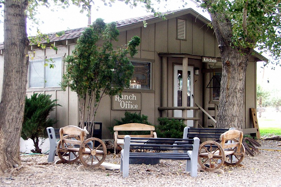
The main office is a multi purpose building housing the office, gift shop, kitchen, ranch hand dinning room, bunk house and show stalls. The day we arrived the office was closed but when Giselle saw us she immediately became a very friendly hostess. While some of our group met Giselle collecting information the rest of us explored the surrounding remains of Camp McGarry.
Camp McGarry was on the old Applegate Trail. Originally 'Fort' McGarry was located near Summit Lake. Around 1866 it was moved to this location as Camp McGarry. It was designed to protect the Idaho-California mail and stage roads and the nearby trails in Nevada and Oregon. Officers' quarters, mess hall, barracks and a 100-horse stone barn were constructed. Camp McGarry was made headquarters of the District of Nevada. In autumn, 1868, troops were moved to Camp Winfield Scott, north of Paradise, Nevada; and Camp McGarry, largest military reservation in Nevada, comprising 75 square miles, was abandoned.
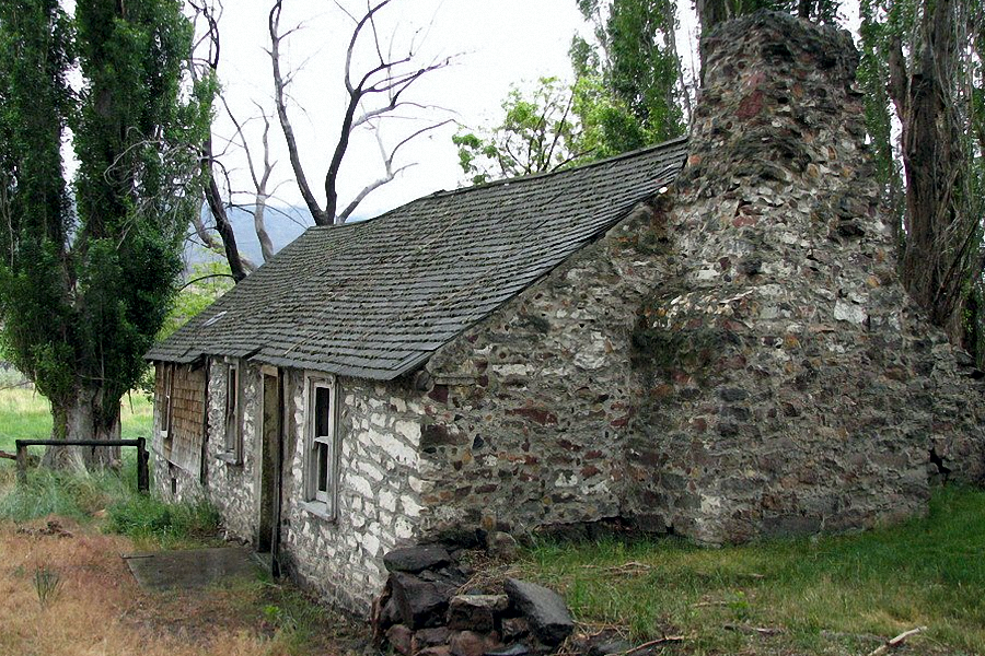
The headquarters of Camp McGarry was this building constructed of local rock. It has stood the test of time and weather for over 100 years. Above is how it looked on previous visits. This year, below, we found it destroyed by fire. It was a shock to all of us who visited in the past. Now it matched the rest of the old Camp structures.
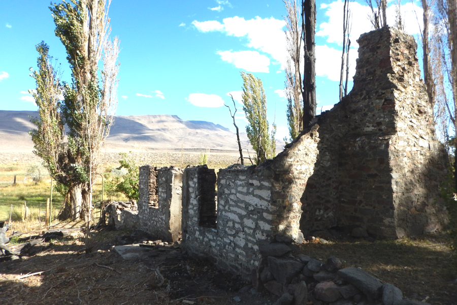
What a shame.
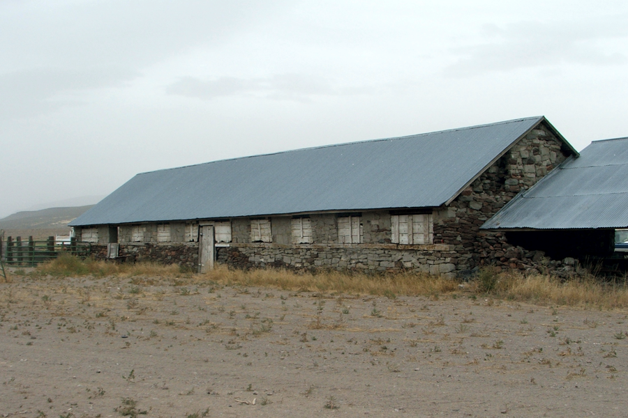
The biggest structure now standing from Camp McGarry is the troop barracks. It supposedly housed 100 troops and is now used as an animal barn. Note the modern metal roof. A newer structure is a remodel building. It is now a small four bed bunkhouse rental.
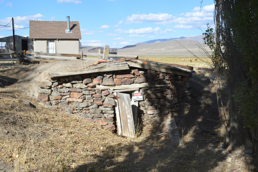
There are several other buildings in various states of disrepair like this underground Powder House
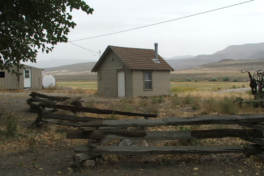
About the nicest building is the Manager's residence built of the same rocks as the rest of Camp McGarry.
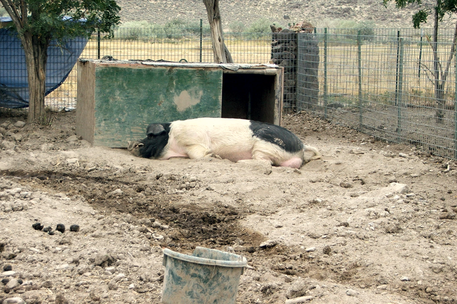
Soldier Meadows is a working cattle ranch. Besides cattle they raise chickens and pigs - big pigs.
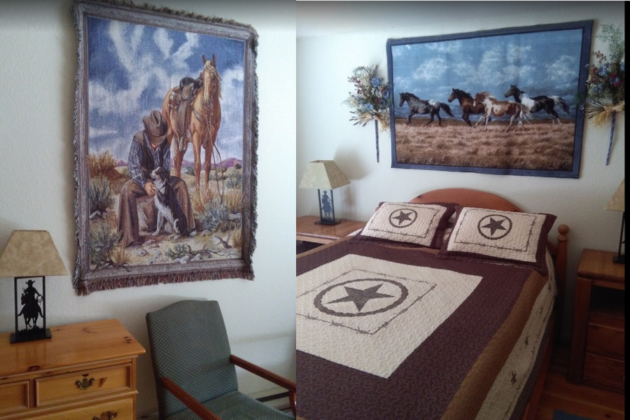
The newest structure at Soldier Meadows is a guest house with two large apartments. They are very clean rentals, both decorated with cowboy atmosphere. While no one got a photo of the outside here are two photos showing the cowboy influence in decor.
After a relaxing rest walking about the old structures we headed back to Gerlach in time for diner at Bruno's. The day was busy and we covered a lot of miles on dirt and rocks, including the Trek back on Soldier Meadows Road with all of it's rocks, ruts and washboard. It was nice to be back in town for nice sit down dinner and socializing.
After diner, with daylight still available, Rich wanted to see the Winnemucca Petroglyphs. Since they are easy to find Tom took Rich and Brandy and headed south on Rt447. The Winnemucca Petroglyphs are about 38 miles south of Gerlach on the right at 40º 06' 59.69" N 119º 22' 18.42" W. The easiest access if from behind as you can travel through the adjacent gravel pit and up a dirt road to the behind. You'll have to park and walk to the rocks to enjoy the artwork. Rich was skeptical about their age but upon actually seeing them he was a believer. These are the oldest Petroglyphs in North America - you can tell just by looking.
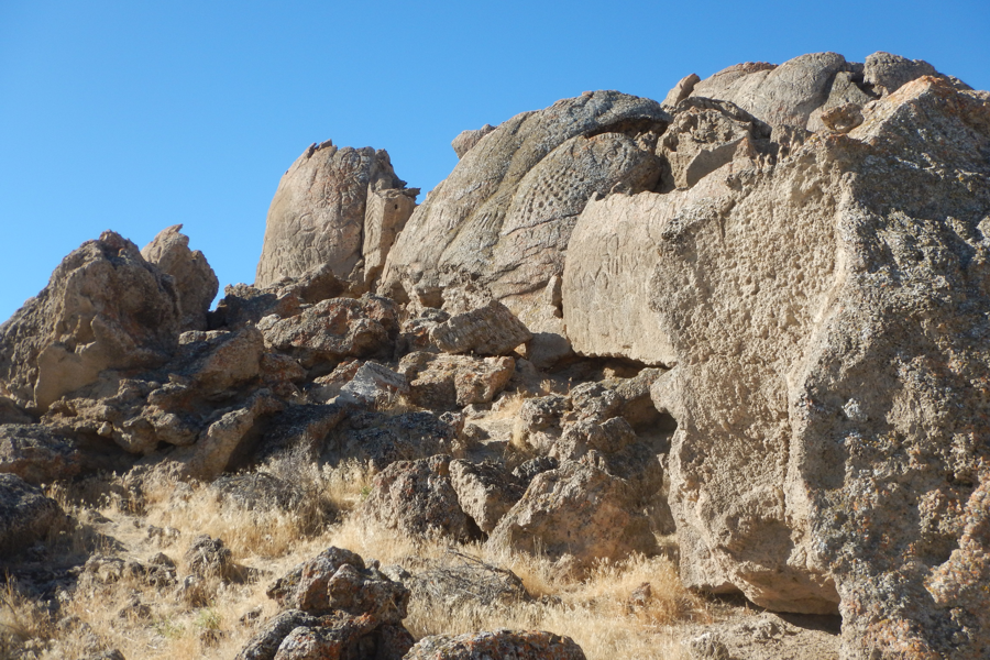
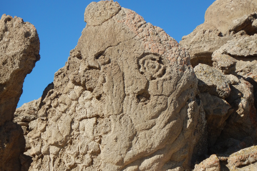
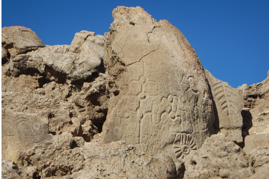
The Winnemucca Petroglyphs are the oldest native art forms in North America. Archeologists claim them to have been created at least 10,500 years ago, and could be as much as 14,800 years old. The Petroglyphs, carved in Tuff by Paleo-Indians a millennia ago, range from simple lines, pits, and swirls to more complex and ambiguous shapes that resemble diamonds, trees, flowers, and veins in a leaf.
The neat thing about these Petroglyphs is that they are right out in the open and everyone driving Rt447 passes by them and never know it. They can be seen about 100 yards away on the West side of the road and are best viewed with the morning sunlight
This area is on the Pyramid Lake Paiute Reservation and is actually closed to non-tribal members. But if you talk nice to them at the Paiute Headquarters in Nixon they might give you permission to take photos. Remember to purchase a Permit while you're there. If you travel off road on the Reservation you best have one of these Permits. |

.