![]()
![]()
June 1 , 2019
First some history . .
One of the federal government's main goals early in the twentieth century was to transfer federal lands to private ownership in order to generate income for the government and provide land and a means of livelihood to citizens. This desire to dispose of government lands led to a series of homesteading laws that were not repealed until 1976. One of the first such laws, the Homestead Act of 1862, allowed a homesteader to claim up to 160 acres of land by living on it continuously for five years and clearing, planting, and irrigating a portion of it for at least four years. Alternatively, a homesteader could purchase a claim for $1.25 or $2.50 per acre, depending on the size of the claim.
In the beginning homesteaders with the potential for acquiring land were Maggie Messner, David B. Fox and Jean Bernard.
Jean Bernard's homestead (Bernard's Place) proved to be in conflict, with just 37.98 acres open. Although the number of acres available to him was greater than those open to Messner, he dropped the matter and the application was canceled on May 20, 1929. Even before the dust settled the court case settled, it was apparent to many that farming was not a viable occupation in the High Rock country. Those who had started out as dryland farmers either began to shift their focus to cattle and sheep ranching or left the area.
Local ranchers were also using the homestead laws to acquire land to broaden their holdings. John Z. Van Riper and his brother Leslie Elmer Van Riper, two of several brothers, were existing ranchers who acquired acreage in the High Rock area. Using a Desert Land entry Leslie Elmer Van Riper acquired 80 acres adjacent to one of his brothers, now known as Van Riper's Place. Leslie Elmer Van Riper had filed for 80 acres in May of 1920 in Hanging Rock Creek, known today as Van Riper's Spring. The canyon that Bernard's Place and Van Riper's Place is located in was known as the East Fork of High Rock Canyon but now is designated as Pole Canyon.
. . History lesson is over.
2019 started early for us with two of our members set out to explore Pole Canyon, which is an off shoot of High Rock Canyon. On June 1st, 2019 Rich Ostaggi and Chuck Duffy set out to find two locations in Pole Canyon.
Their distinations were to find, what most people claim to be two Hunter/Trapper dwellings, both of which very little information is to be found on them but the locations show up on Google Earth. They are Bernard's Place and Van Riper's Place. Not much is known of the two 'owners' but the history above reveals some interesting facts.
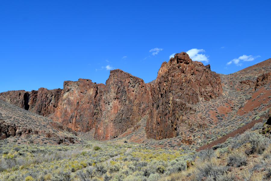
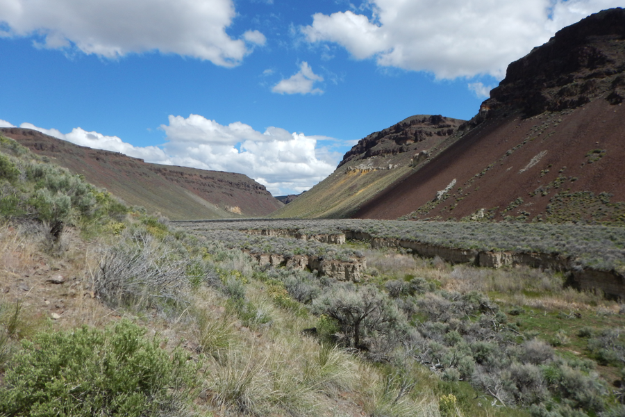
Starting up High Rock Canyon you find the three high rocks of the Canyon's iconic Post Office at 41° 20' 12.5" N 119° 20' 39.8" W . About 2 miles North of this begins Pole Canyon, 41° 21' 29.2" N 119° 21' 58.3" W , a roadless canyon best accessible by hiking. We had to park our side by side and begin to hike the marsh land and cow paths. This is a wilderness area.
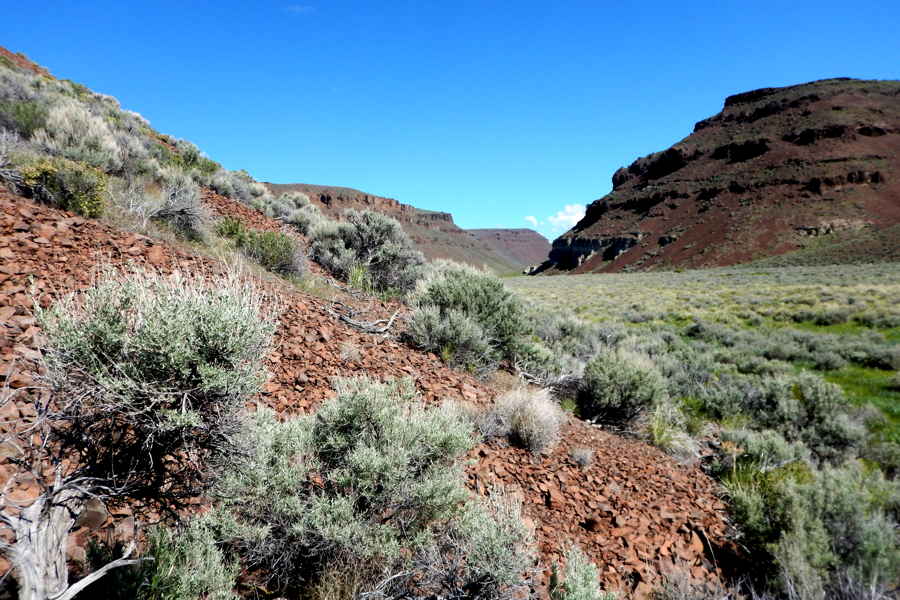
Spring rains made for a hard Trek crossing back and forth over a stream and marshes. 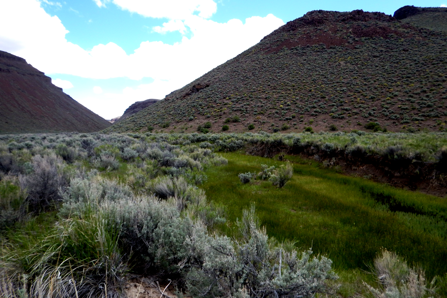
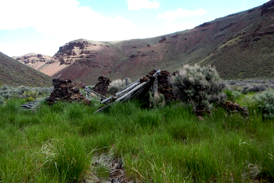
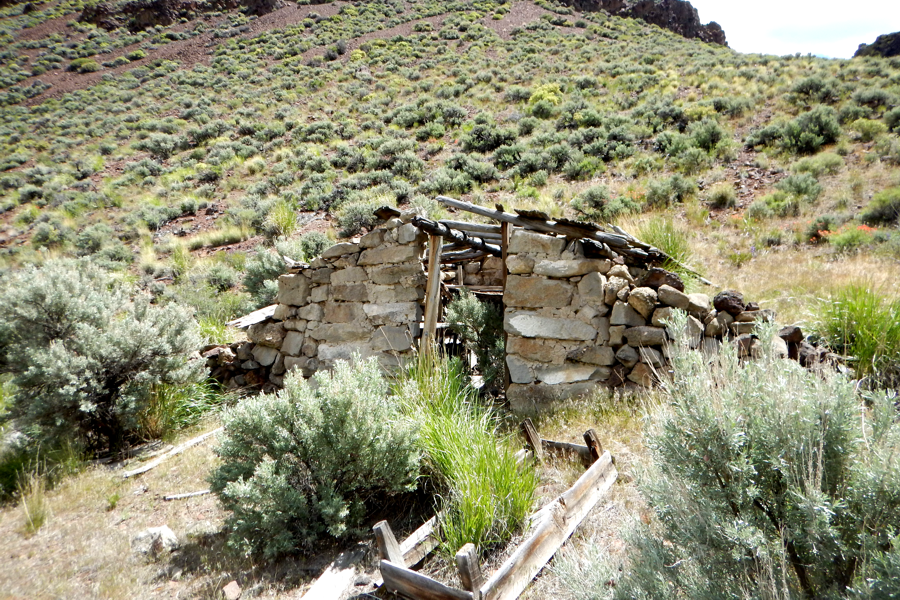
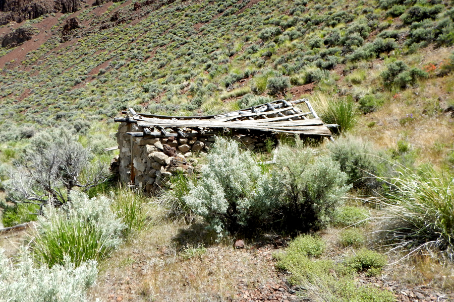
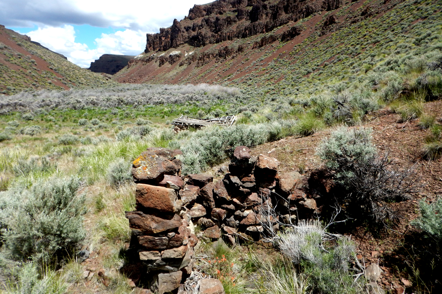
Its about a 2 mile hike up Pole Canyon before you find Bernard's Place. There are two structures and some artifacts.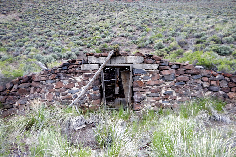
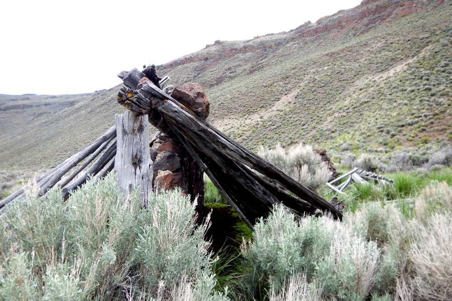
What appears to be Bernard's house (if you can call it that) is located at 41° 23' 04.5" N 119° 22' 52.0" W (above). What seems to be maybe the Barn is a short 200 foot walk North at 41° 23' 05.6" N 119° 22' 49.4" W (below).
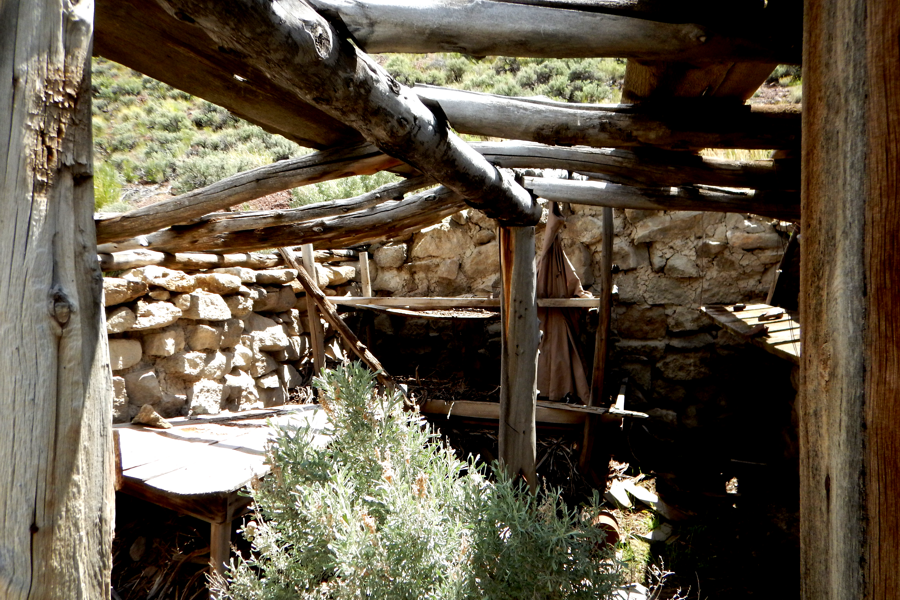
The inside of the house looks spacious yet crude, but still it was a house.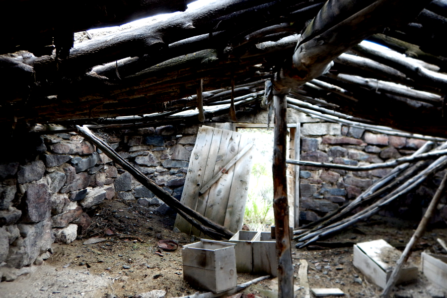
Looking out the front door of Bernard's 'house'..
Looking toward the rear. That's the bed room on the left.
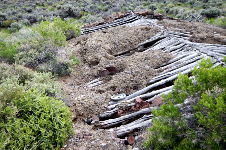
You can see how the sod roof has tried to survive, but the weather is doing its worst.
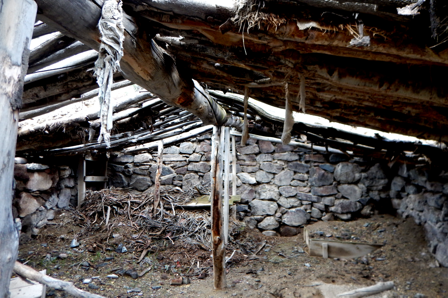
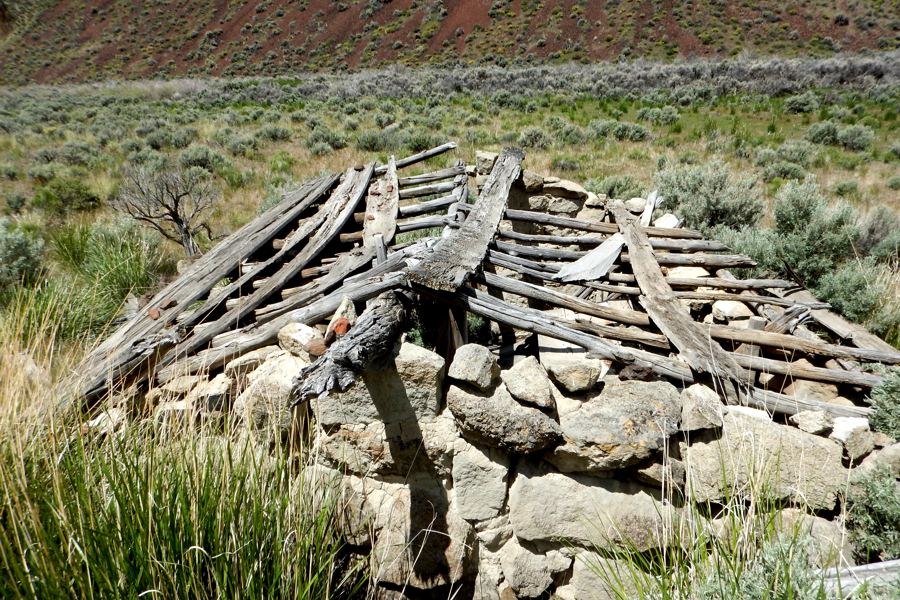
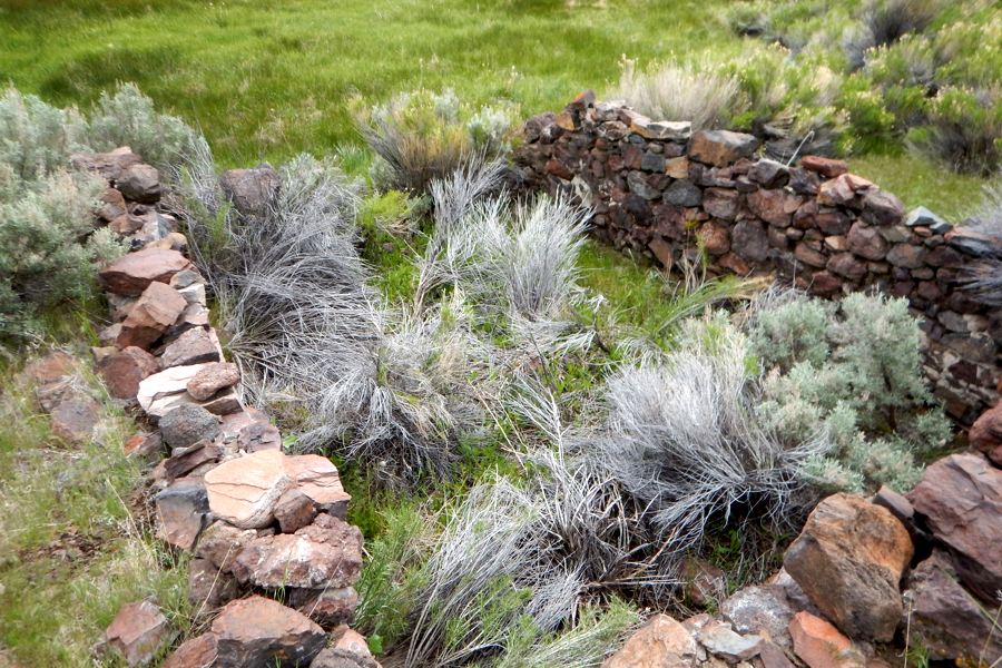
The roof of the barn is in even worse shape.
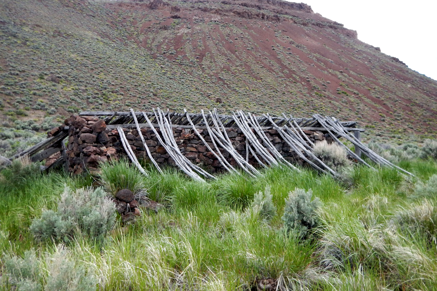
There looks like a stone wall ran through the center of the barn and the roof poles spread in both directions.
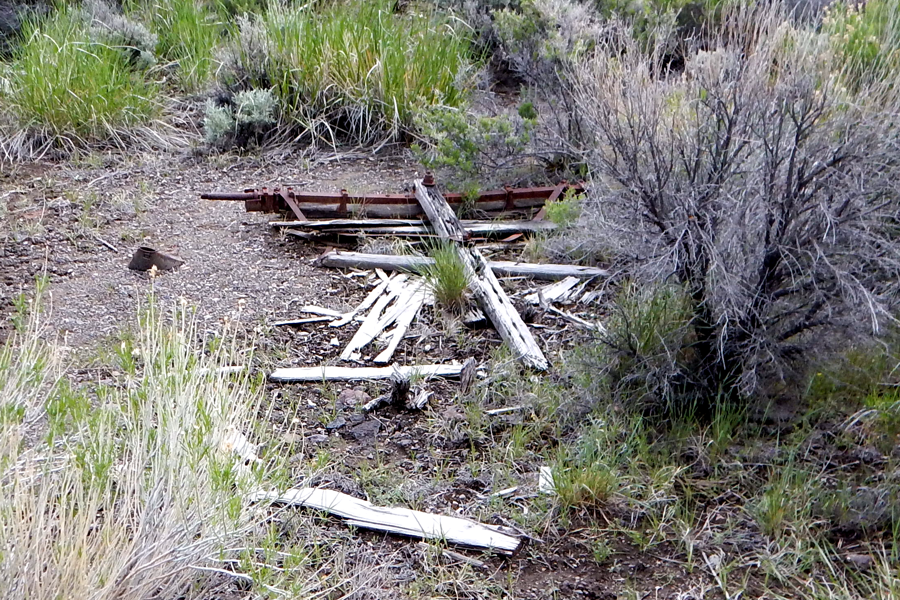
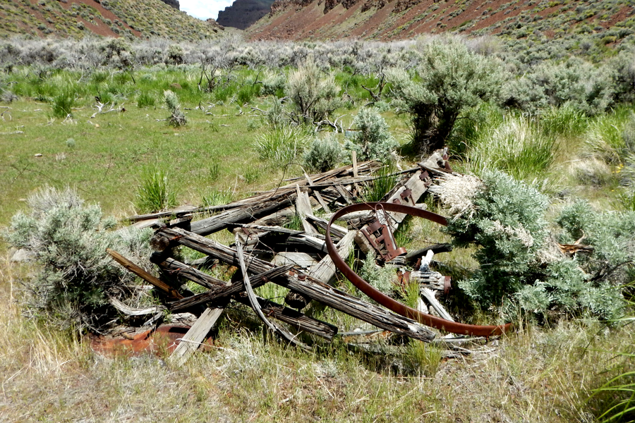
We found the front end and axle of a large wagon
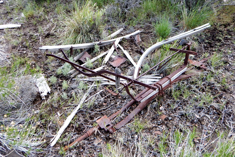
The rear axle of the same large wagon
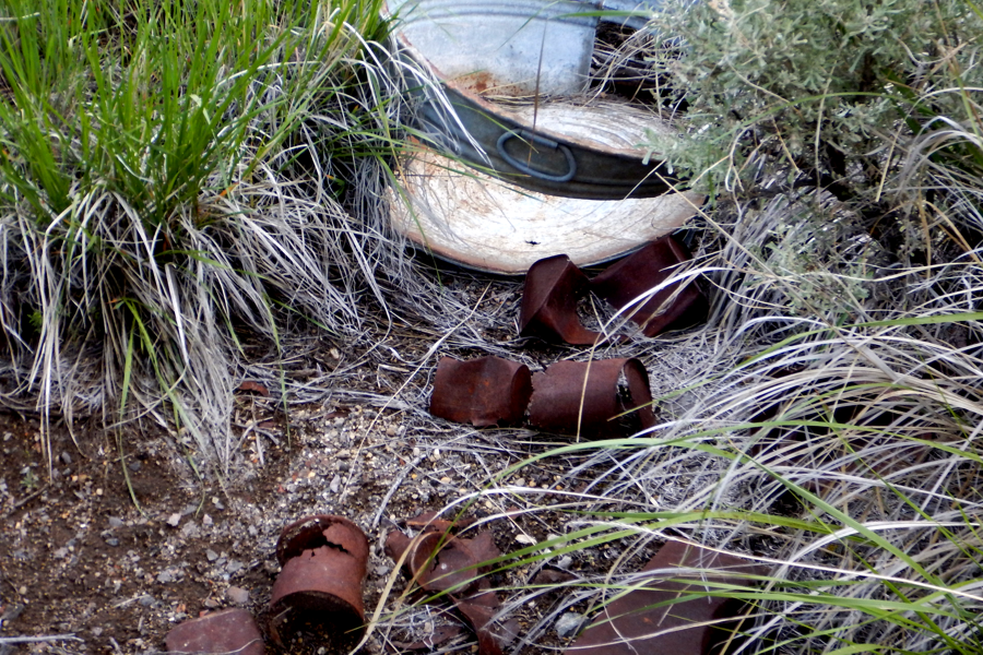
There are cans there dating between 1880's - 1904. Someone we talked to said it was depression era but they're older than that.
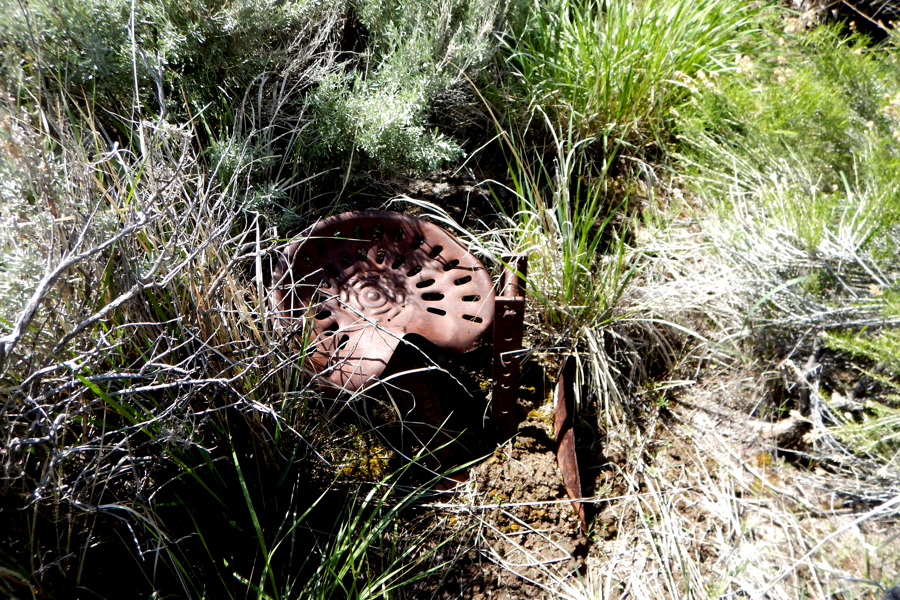
Heading North to Van Riper's Place we found a tractor, still part of Bernard's Place.
To get to Van Riper's you must once again cross over a ravine. Finding paths was a full time job.
The Van Riper homestead near Van Riper Spring uses some large heavy white rocks.
Van Riper's sets on a slight hillside. The white rocks had to be hauled in since there are not such rocks nearby.
The interior has bunk beds in the rear, a table and a storage area..
The roof has flat planks as opposed to Bernard's sod roof.
We found what is left of a rather large wagon needed to haul supplies in to the homestead, and probably the white rocks as well.
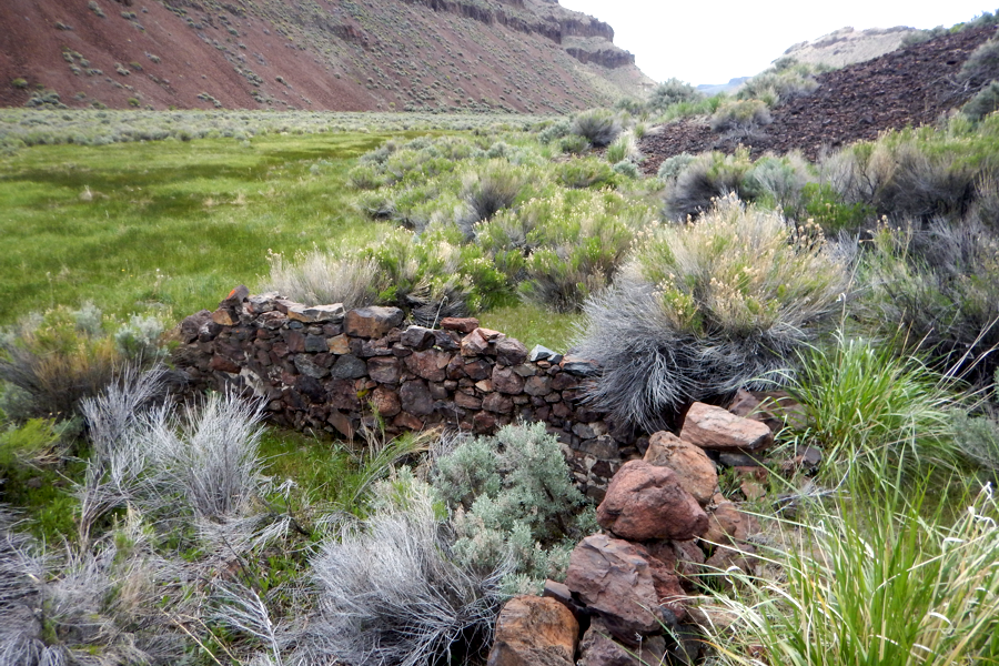
A small remain sits 150 feet north of Van Riper's house which can be seen in the background.
On the way back to High Rock Canyon and our side by side, we found a structure ruin heading South on the West side.
It was dug into the rim
at 41° 22' 28.6" N 119° 22' 28.6" W
3/4 mile South of Bernard's
Place.
We have no clue as to what this place was but it's there just the same
.
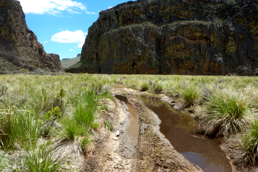
Once back in our side by side we head back thru High Rock Canyon. The road was muddy and flooded in more than many places.
As we departed Pole Canyon we spotted two ruins very near Pole Canyon entrance which we did not have time to explore.
Bernard's Place and Van Riper's Place are in such remote places it is hard to figure out what the worth was. Even if it involved homesteading it would be a big ordeal to get supplies to, and goods from there, to market. Could these people only wish to grab as much land as they could maybe for grazing? Yet all in all it was a good Trek that took an entire day. If you like to hike come visit.
CLOSING NOTE: There does exist a place known as Bernard's Corral. It is about 5 miles near directly North of Bernard's Place at 41° 27' 10.6" N 119° 23' 35.7" W . It was probably a place to gather wild horses for Bernard's Place.
