![]()
![]()
►►ZOOM IN FOR DETAILS◄◄
►►CLICK HERE TO VIEW LARRY'S CAVE IN GOOGLE MAPS◄◄
40º 15’ 31.46” N 119º 47’ 15.50” W
To fine Larry's Cave head north out of Sutcliffe, Nevada on Rt445 N (Pyramid Lake Road). It then becomes Surpise Valley Road (also known as Smoke Creek Road). About 30 miles out of town if you pay attention on the left hill side you'll spot the chain link fence and the cave entrance.
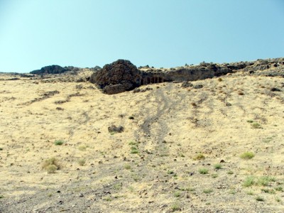
Larry's Cave was found heading south to Sutcliffe, Nevada from Gerlach, Nevada on Smoke Creek Road. As we approached SAND PASS, a collection of old buildings, we looked west and spotted some chain link fence up in a rock formation. Getting out of the car we head up a gradual incline hill. Larry Benek was the first to reach it thus claiming rights to the name. Tom followed second delayed by insistant yelling from Dave, "Don't go in there!"
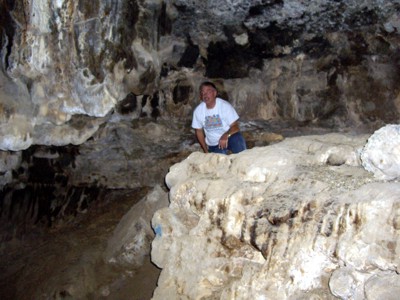
The interior photos below were taken with just the flash of a digital camera. Next time we'll take flashlights!
Click On Images For Larger Versions |
|
 |
 |
Larry's Cave as seen from Smoke Creek Road below. |
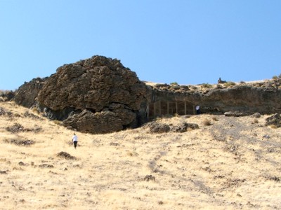
The climb up was not hard. Larry's up top, Tom's still hiking.. |
 |
 |
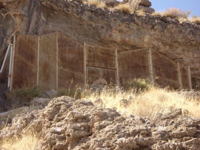
A large chain link fence protects the cave entrance. |
Larry inside near the cave's entrance . |
 |
 |
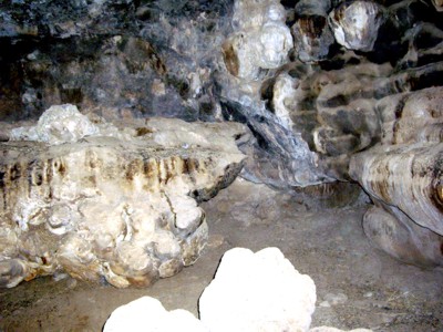
It's hard to define things. This looks down to a chamber below. |
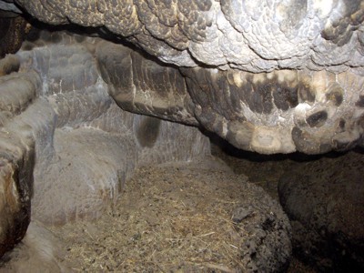
Another area apparently used by critters for sleeping. |
 |
 |
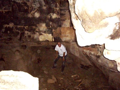
Tom down in a lower Chamber. |
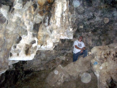
Larry in the upper chamber. |
In the map above, Sand Pass is located directly east northeast of Larry's Cave. Zoom in on the map and you'll find Sand Pass right on the curve of the rail road tracks. Click HERE to go to Sand Pass.
Mines, open shafts, drifts going into mountainsides and old buildings, are all DANGEROUS. Be aware of your surroundings, and let someone know where you are, especially if your plans change. We know your plans will change. |